Skills
Map Reading
Disclaimer: The information for Map Reading and Grid References under the skills section is aimed to provide a general overview of these subjects. It is only when these skills are applied, with the aid of a qualified and experienced instructor in a real environment, you will be able to use them competently.
GPS and Apps have become a mainstay in our lives over recent years. They provide excellent assistance when planning and navigating walks. However, they should not be used in isolation and replace maps and compasses. When all else fails, and you find yourself in a situation where there is either is no 3/4/5G signal or where the satellite GPS systems are not available, then the ability to read a map and use a compass is absolutely essential.
The number of people who walk regularly but shy away from basic map reading is surprisingly large. Certainly anyone who walks alone in unknown or mountainous areas should have some map reading and navigational skills, but even in familiar territory navigation is easy and can be fun.
Buy a few maps of your favourite areas and learn to use them .
Using a map
A map is a two dimensional model of the landscape. Map reading is the ability to look at a map and process it into a mental picture of the landscape, an important skill in selecting and following a route.
Scales.
Maps come in a wide range of scales. The two most popular maps of the British isles used by hill-walkers are:
- 1: 50,000, on this scale 2cm on the map = 1km on the ground
- 1: 25,000, on this scale 4cm on the map = 1km on the ground
Obviously the 1: 25,000 provides more information but you will need more maps to cover the same area.
1: 50,000 are readily available for all parts of the British Isles and 1: 25,000 are available for popular walking areas.
Grid References.
So what are the vertical and horizontal lines on the map?
The British and Irish grids divide the British Isles into squares, each square is 100km x 100km and identified by a letter. (e.g) most of the Mournes is within grid letter J and much of the Sperrins within grid letter H
Each area within the bounds of each grid letter is further divided into 1km squares by grid lines. These are the numbered and marked lines we see on the map. They run North-South and East-West.

So how do we get a grid reference?
- First determine the letter which defines the 100km grid.
- This letter can be found on the map legend and in this case is H-see top left hand corner of map.
- The Eastings run across the map in this case from 45-53
- The Northings run vertically on the map-in this case from 93-100
- H4796 is the four figure grid reference for Balix Hill -not very accurate it covers a fairly large area 1km x 1km
- A six figure grid reference reduces the error and gives a reading within 10m x 10m. The grid reference for Balix Hill would become H475962-much more accurate.
- An eight figure grid reference is accurate to 1m x 1m-but of course in this case the grid reference must be taken very accurately.

Six figure grid references are probably the most accurate possible with a 1: 50,000 map
Eight figure grid references are easier to obtain from a 1: 25,000 map.
Using a 1: 25,000 map of the Sperrins an eight figure grid reference can be readily estimated using the 1: 25,000 scale on a Silva Walkers Compass
Corick Mountain has twin tops, the higher at 430m has a grid reference C76070367
Setting a map.
When using a map it is good practice to keep it set, a map is the right way relative to the ground when set.
A map can be set:
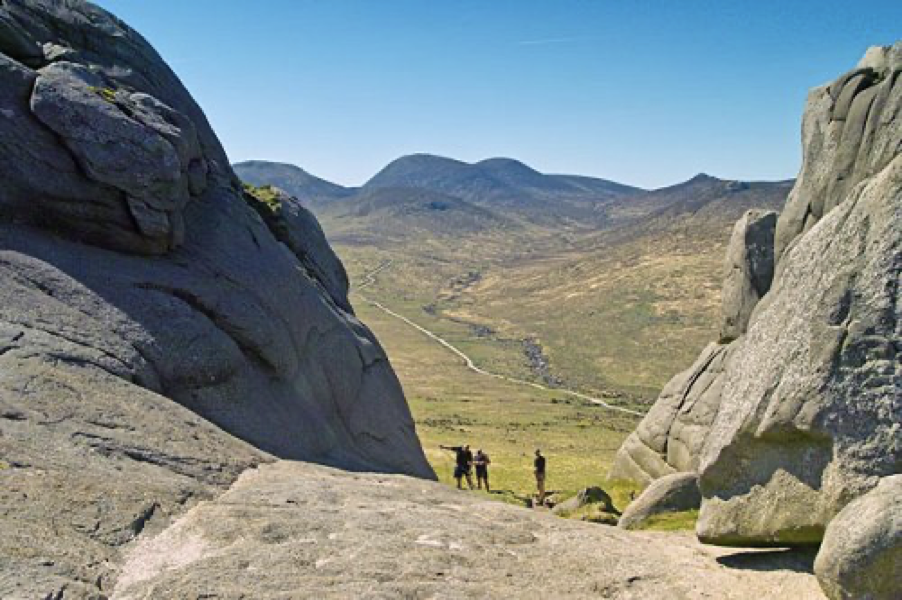
By using a compass to align the grid lines to the North or using familiar or known ground features so that the directions of these features on the map and on the ground are the same.
Compare the equivalent map set N-S, with arrow pointing south.
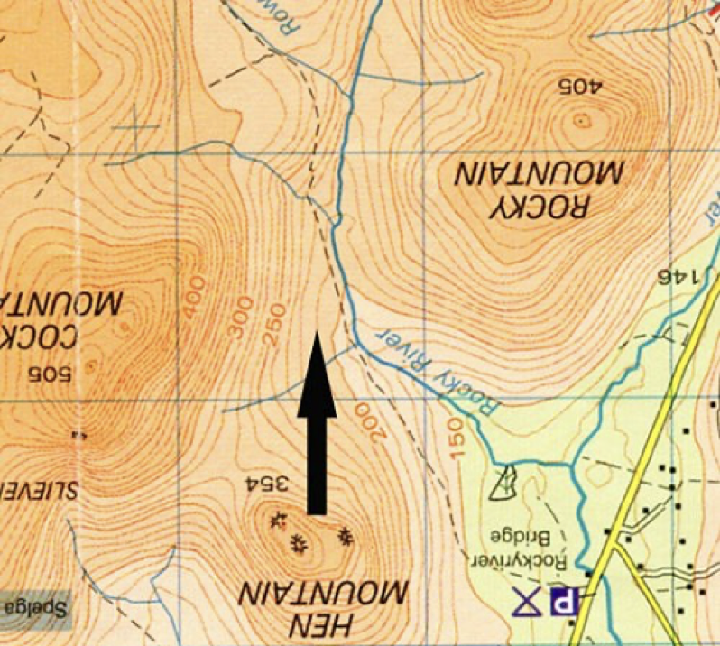
Grid References Training
Where is North?
True North is the direction to the North Pole, this can be ignored for hill-walking purposes (except possibly at night, with no equipment and with only the Pole Star to navigate by).
Grid North is Map North and is the direction to which the grid lines on a map point.
Magnetic North is the direction in which the compass needle points. In Northern Ireland Magnetic North is roughly 10° west of Grid North -this difference is known as the magnetic variation.
Magnetic variation is not constant.
It varies from place to place, and is slowly changing with time. We must take into account the difference between grid and magnetic north when converting between bearings on a map and bearings on the ground.
Working out a direction of travel.
The most common use of a compass is to identify a required direction of travel to reach a point, hidden because of either poor visibility or terrain.
The direction of travel is measured from the map, adjustment is made for magnetic variation and the compass used to indicate the direction of the object.
Use the 1 : 25,000 Mournes Map Which is easier to work with . Find Slieve Donard and Crossone and assume you are on top of Donard and wish to use a compass to reach Crossone.

1. Hold the map flat.
2. Place one of the long edges of the compass along the imaginary line Donard and Crossone on the map, making sure that the direction of travel arrow is pointing towards your destination -Crossone
3. Now rotate the dial of the compass so that North on the dial is pointing towards the North of the map by aligning the parallel lines on the base of the compass dial with the north/south grid lines on the map. Read off the bearing (green dot on the map) at the direction of travel indicator.
From Donard to Crossone the bearing should be 106°- this is the grid bearing.
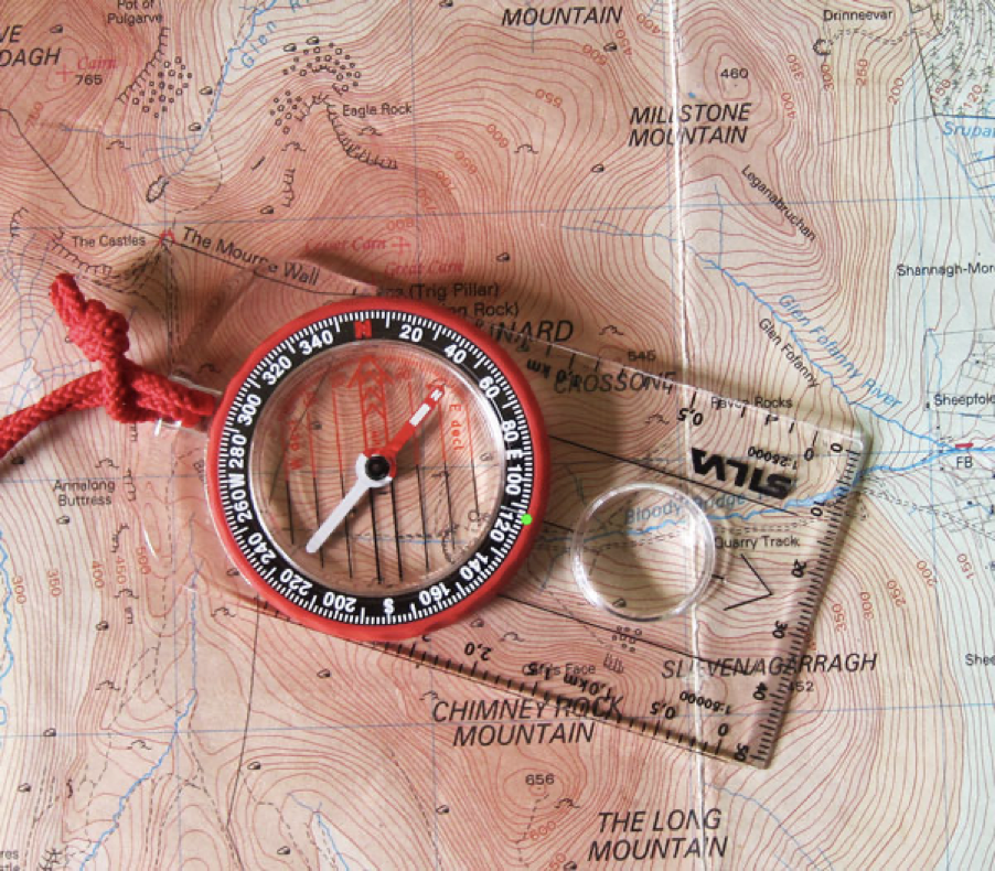
4. Magnetic variation in the Mournes is about 8°-check this from map legend. This variation must be added to the grid bearing already calculated. The magnetic bearing is therefore 114
5. Rotate the dial to the new bearing-green dot
6. Now the interesting bit-hold the compass flat and rotate the whole compass until North on the dial is pointing to Grid North on the map.
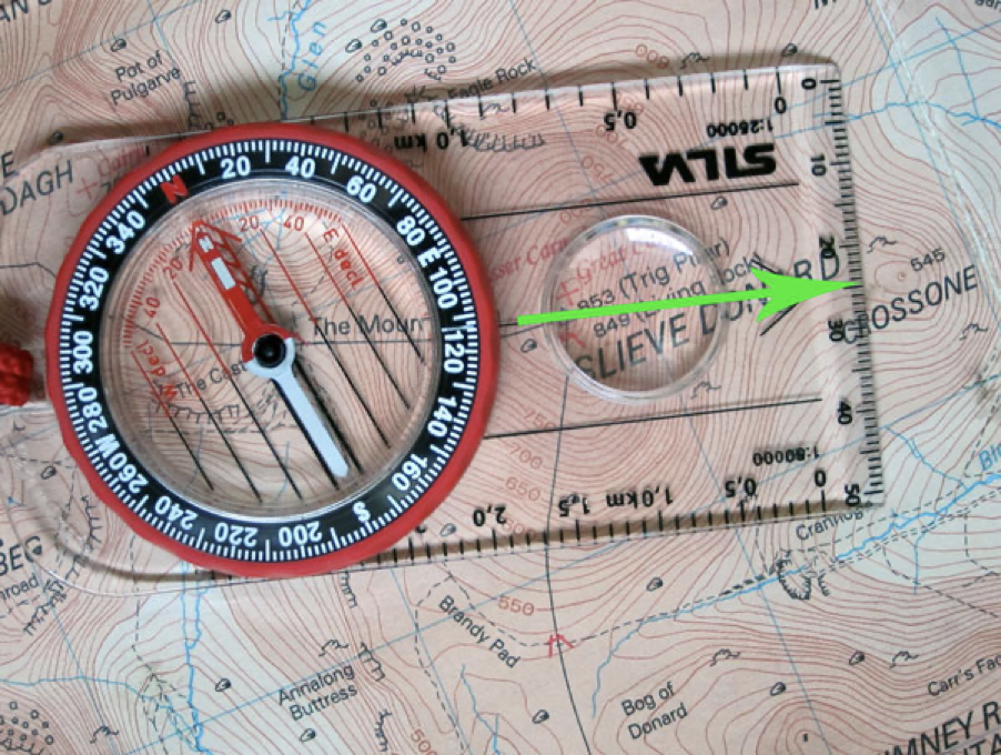
The direction of travel indicator shows the direction of Crossone from the top of Slieve Donard-green arrow superimposed in picture.
Off you go and don’t get lost .
Remember, accuracy is important. An error of 6° will put you 100m of course after walking 1km. In poor weather you might only see 10m !! Think of hitting a golf ball-a small angle of error in the clubface leads to a ball well off line.
